Duncan-Parnell Adds Microdrones Surveying Drones to Geospatial Product Offerings
At Duncan-Parnell we aim to provide our customers with the tools they need to succeed in the field. Our advanced geospatial surveying solutions help you do more work with fewer resources, while saving your company time and money. From Trimble geospatial surveying equipment to GIS mapping solutions, monitoring solutions and more, our business has expanded over the years to provide you with reliable, industry-leading tools and tech. To continue growing with today’s advancements in technology we are happy to announce we have partnered with Microdrones to bring you complete drone LiDAR and Photogrammetry systems for surveying, mapping and GIS.
You already trust us with your surveying needs, and with the introduction of Microdrones we’re excited to provide you with an easy and comprehensive way to introduce aerial surveying into your workflows.
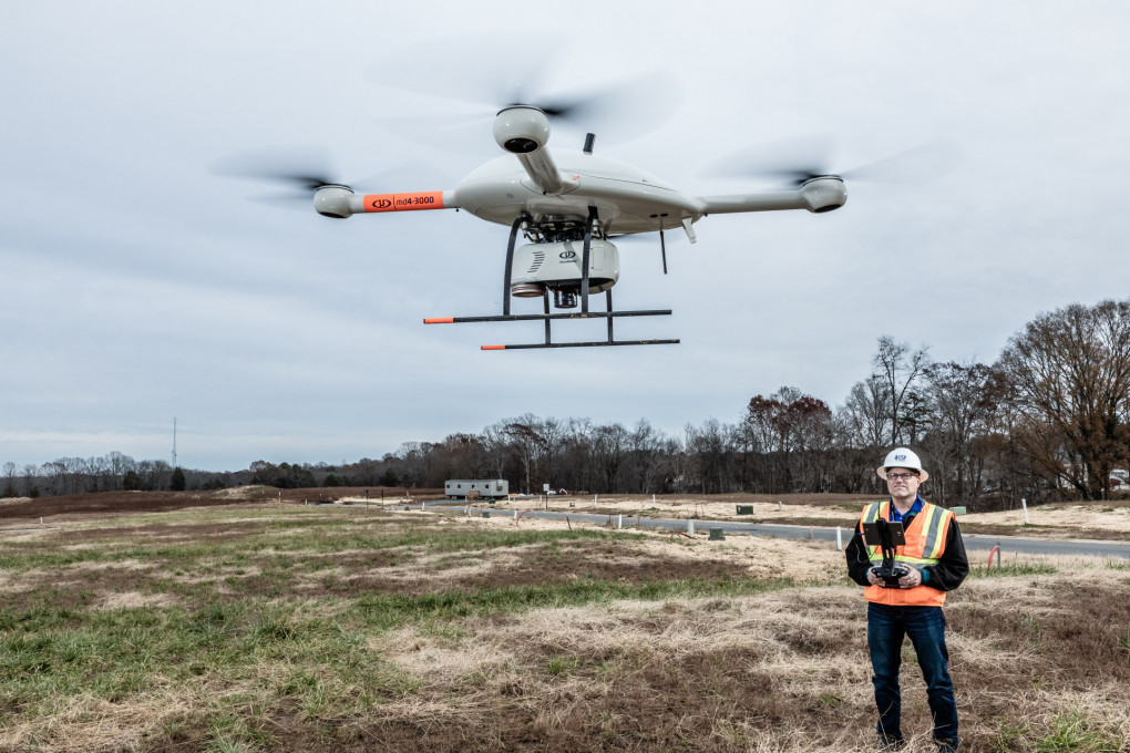
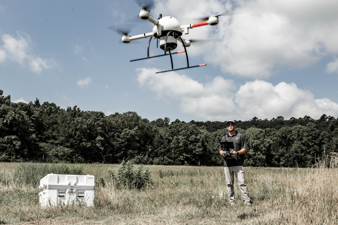
Microdrones is an industry-leading UAV manufacturer that creates complete solutions with surveyors in mind. More than just drones, these total UAV (Unmanned Aerial Vehicles) systems come complete with drone surveying equipment, software, workflow, training and support.
Part of what makes Microdrones different than other drones available on the market is how the devices are made to integrate with other surveying tools, including software from Trimble, for a seamless user experience. Additionally, Microdrones offers unique mdMapper and mdLiDAR packages that integrate high-performance drones with advanced sensors and software.
More than Just Drones:
Aerial surveying is not just about the aircraft. It’s about total UAV systems, complete with drone surveying equipment, software, workflow, training and support. mdMapper and mdLiDAR packages from Microdrones integrate high-performance drones with advanced sensors and software for easy use and quick learning.
- mdLiDAR: End-to-end LiDAR systems combining drones, LiDAR & photogrammetry payloads, a fully integrated software workflow and world class support to consistently provide quality data deliverables. Use mdLiDAR to produce 3D point clouds optimized for land surveying, construction, oil & gas, and mining applications.
- mdMapper: Significantly reduce your time spent on projects and deliver unparalleled data quality. Get complete UAV photogrammetry mapping and surveying packages and become invaluable to your clients’ success.
Why Choose Microdrones:
We partnered with Microdrones because of their reputation for superior aircraft design, industry-leading flight times, increased resistance to harsh conditions and smart integration.
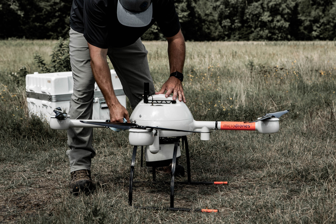
• Rain and Heat Resistant: Microdrones’ molding process keeps electronics and wiring protected from the elements you may encounter in the field. These systems are resistant to rain, sand and salt – so you can trust your device flying even in harsh conditions.
• Reliable Motors for Minimum Downtown: Microdrones utilizes brushless, low RPM motors and large props that work seamlessly and efficiently to provide unmatched performance.
• Stable Flights for Precise Results: Micro-controlled drive systems instantly respond to changing winds to maintain the proper flight altitude. When mapping, stable flights deliver more accurate and precise data.
• Robust Housing and Components: The occasional rough landing is unavoidable, but robust carbon fiber construction is built to withstand. Carbon fiber is also used to insulate interior components so you can fly even in extreme temperatures and humidity levels.
• Stable and Enduring Configuration: Microdrones utilizes a plus sign (+) shaped configuration to create a more practical and stable device. With a motor on the front, the rear and each side, the airframe remains more stable in level flight and during turns. This configuration uses less energy to maintain stability, allowing the extra power to go towards carrying heavier payloads.
• Proprietary Operating System: Microdrones’ lean, proprietary operating system, mdOS, serves as the foundation for a flexible autopilot, so you can customize it to meet the specific needs of your mapping project.
• Plan, Monitor and Analyze in the Field: The mdCockpit tablet enables you to plan, monitor and analyze your mapping mission. It contains all the tools you need to quickly set your fight plan and waypoints with just a few flicks of your finger.
• Tested for High Voltage Fields: Fly your Microdrones UAV near power lines with confidence. Microdrones’ quadcopters are rigorously tested for interference up to 380 kV in a high-voltage lab.
If you’re interested in taking your surveying to the next
level or would like to learn more, reach out to us here.